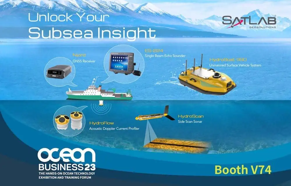

SatLab Geosolutions, based in Sweden, develops high-precision geospatial technologies and surveying solutions. The company’s portfolio includes 3D SLAM mapping systems, GNSS positioning solutions, and Hydrography & Oceanography products, including Unmanned Surface Vehicles (USVs) equipped with multi-beam, single-beam, and ADCP sensors. These solutions enable comprehensive water and environmental surveys, including bathymetric mapping, river and channel monitoring, dam and slope inspections, and other hydrographic and coastal applications.
Supported by 11 international service centers and over 100 authorized dealerships, SatLab offers global support and turnkey solutions across civil engineering, construction, mining, forestry, agriculture, hydrology, coastal engineering, marine survey operations, and digital twin generation. SatLab’s solutions combine hardware, software, and workflow optimization to help professionals capture actionable geospatial and marine intelligence, enhancing operational efficiency and decision-making.

Rooted in Swedish engineering and continuous R&D, SatLab ensures reliability, precision, and field-ready performance. Guided by their “Unlock Your Mobility” vision, they empower surveying and marine professionals to expand capabilities, achieve operational mobility, and implement innovative, end-to-end geospatial and marine solutions in evolving environments.