Suppliers: Drone LiDAR

Inertial Labs, a VIAVI Solutions Company

Inertial Navigation Sensors: MEMS IMU, Accelerometers, Gyroscopes, AHRS, GPS-INS & Point Cloud Generation

Areté

Cutting-Edge Unmanned Systems-based Sensing Solutions & Counter-UAS Systems for Military & Defense Forces

SatLab Geosolutions

GNSS Positioning Systems, 3D SLAM & Mobile Mapping, Unmanned Surface Vehicles

Voyis

AUV Payloads & ROV Skids: Underwater Laser Scanners & 4K Stills Cameras for Subsea Inspections & Surveys

YellowScan

High Precision, Long-Range UAV LiDAR & Drone LiDAR Mapping Solutions

RIEGL

Drone LiDAR Sensors & Laser Scanners for Aerial Surveying, Mapping & Bathymetry

CHC Navigation

GNSS Positioning & Navigation Systems, Mobile Mapping UAV LiDAR & Unmanned Surface Vehicles

Showcase your capabilities

If you design, build or supply Drone LiDAR, create a profile to showcase your capabilities and connect with visitors who have an active requirement for your solutions.

Create Supplier Profile

Products

39 Cutting-edge Solutions
Add your solutions
Teledyne EchoONE

Ultra-lightweight Airborne LiDAR System

Ultra-lightweight Airborne LiDAR System
...anced airborne LiDAR solution engineered for UAV-based mapping and high-accuracy geospatial data... ...ation airborne LiDAR system designed for high-precision geospatial mapping and unmanned aerial...
RESEPI GEN II LiDAR Scanning Solutions

Next-generation sensor fusion platform for UAV remote sensing

Next-generation sensor fusion platform for UAV remote sensing
... high-accuracy LiDAR point cloud generation solutions is designed for Inertial Labs partners and...
RESEPI Lite LiDAR Scanning Solutions

High-accuracy sensor fusion platform for UAV remote sensing

High-accuracy sensor fusion platform for UAV remote sensing
... high-accuracy LiDAR point cloud generation solutions is designed for Inertial Labs partners and...
YellowScan Venturer

NDAA-Compliant UAV LiDAR for Survey-Grade Aerial Mapping

NDAA-Compliant UAV LiDAR for Survey-Grade Aerial Mapping
...NDAA-compliant UAV LiDAR engineered for professional drone mapping and geospatial data collection....
YellowScan Navigator

Bathymetric & topographic LiDAR survey solution

Bathymetric & topographic LiDAR survey solution
...s simultaneous UAV-based surveying of land and water. The compact and lightweight unit can be...
YellowScan Explorer

Long-range, multi-platform LiDAR solution

Long-range, multi-platform LiDAR solution
...is a versatile LiDAR solution designed to be fitted to a range of UAV platforms, including...
YellowScan Vx15 Series

Long range, high precision UAV LiDAR solution

Long range, high precision UAV LiDAR solution
...high-precision UAV LiDAR mapping solution, incorporating a Riegl Mini-VUX LiDAR sensor and an...
YellowScan Voyager

Long-range UAV LiDAR solution with wide field of view

Long-range UAV LiDAR solution with wide field of view
... is a powerful UAV LiDAR scanning solution designed to capture complex and vertical targets, and can...
YellowScan Surveyor Ultra

High density and long-range UAV LiDAR solution

High density and long-range UAV LiDAR solution
...ity 360-degree UAV LiDAR mapping solution, incorporating a Hesai XT32M2X LiDAR sensor and an...
YellowScan Mapper+

Compact high-performance UAV LiDAR solution

Compact high-performance UAV LiDAR solution
...nd easy-to-use lidar system....
YellowScan CloudStation

LiDAR point cloud processing software

LiDAR point cloud processing software
CloudStation is the proprietary software developed by YellowScan to generate and visualize point-clo...
YellowScan Vx20 Series

Our most accurate and high precision UAV LiDAR solution

Our most accurate and high precision UAV LiDAR solution
...ly integrated, LiDAR UAV mobile mapping system from YellowScan’s product range....
YellowScan Mapper

Next-generation integrated UAV LiDAR mapping solution

Next-generation integrated UAV LiDAR mapping solution
Start your LiDAR journey with our easy-to-use Mapper system. Its low weight, mid-range capability,...
LiSA

Situational awareness LiDAR for degraded visual environments

Situational awareness LiDAR for degraded visual environments
LiSA (Lidar for Situational Awareness) is a UAS-deployable sensor that is designed to provide...
RIEGL VUX-820-G

Topo-bathymetric airborne LiDAR system for coastal & river mapping

Topo-bathymetric airborne LiDAR system for coastal & river mapping
...820-G airborne LiDAR System is a compact 5.7 kg unit designed for UAV-based topo-bathymetric mapping...
RIEGL VUX-10025

UAV LiDAR Scanner with Extra Large Field of View for Wide Area Coverage

UAV LiDAR Scanner with Extra Large Field of View for Wide Area Coverage
... as standalone UAV LiDAR sensor and also in various fully-integrated UAV-based laser scanning system... ... and versatile LiDAR scanner that provides an extended field of view of 160 degrees for extra-wide...
RIEGL VQ-840-GE

Fully integrated laser scanner for combined topographic & bathymetric survey

Fully integrated laser scanner for combined topographic & bathymetric survey
...t designed for UAV-based combined topographic and bathymetric surveying, and can penetrate up to 2...
RIEGL VQ-860-G

Airborne laser scanner with enhanced depth performance

Airborne laser scanner with enhanced depth performance
...ble for larger drone platforms. It has been designed with a rugged mechanical structure and a dust-...
RIEGL VUX-180²⁴

UAV Lidar Scanner for High-Speed Applications

UAV Lidar Scanner for High-Speed Applications
... a lightweight UAV LiDAR scanner that provides a 75-degree field of view, extremely high pulse... ...e-art Waveform-LiDAR technology, providing features such as echo digitization, online waveform...
RIEGL VUX-240²⁴

Upgraded high-point density laser scanner for UAVs

Upgraded high-point density laser scanner for UAVs
...e-art Waveform-LiDAR technology provides echo digitization, online waveform processing, and...
RIEGL VQ-840-GL

Light-Weight LiDAR Scanner for Combined Topographic and Bathymetric Surveying

Light-Weight LiDAR Scanner for Combined Topographic and Bathymetric Surveying
...stem ideal for UAV integration....
RIEGL VUX-160²³

High-Point-Density UAV Laser Scanner for Corridor Mapping

High-Point-Density UAV Laser Scanner for Corridor Mapping
...is a versatile UAV LiDAR scanner with a 100-degree field of view and incredibly fast data...
RIEGL miniVUX-3UAV

High-density lightweight LiDAR scanner for UAVs

High-density lightweight LiDAR scanner for UAVs
...nique Waveform-LiDAR technology enables echo digitization and online waveform processing, with...
RIEGL VUX-120²³

High-Point-Density UAV Laser Scanner for Corridor Mapping

High-Point-Density UAV Laser Scanner for Corridor Mapping
...is a versatile UAV LiDAR scanner with a 100-degree field of view and incredibly fast data...
RIEGL VUX-1UAV22

Lightweight, Survey-Grade UAV LiDAR Sensor

Lightweight, Survey-Grade UAV LiDAR Sensor
...a survey-grade LiDAR sensor, with a rugged compact design that allows it to be easily mounted to...
RIEGL miniVUX-1UAV

Compact and Extremely Lightweight UAV LiDAR Sensor

Compact and Extremely Lightweight UAV LiDAR Sensor
...nique Waveform-LiDAR technology allows echo digitization and online waveform processing, with...
Cygnus Lite Handheld SLAM Scanner

Ultra-lightweight mobile scanner with dual wide-angle cameras

Ultra-lightweight mobile scanner with dual wide-angle cameras
The Cygnus Lite is a highly portable SLAM scanner featuring a 20° tilt mechanism and dual 12MP HD w...
Cygnus 2 Handheld SLAM Scanner

Precision portable scanner with centimeter-level accuracy

Precision portable scanner with centimeter-level accuracy
...bines advanced LiDAR with visual fusion SLAM technology and RTK GNSS to provide high-density point...
Apus-MX LiDAR Scanner

UAV LiDAR scanner with orthographic camera

UAV LiDAR scanner with orthographic camera
...ful long-range LiDAR scanner with an advanced IMU and an industrial-grade 45 MP RGB orthographic...
Cygnus Handheld SLAM Scanner

Mobile 3D scanner for precise point cloud acquisition

Mobile 3D scanner for precise point cloud acquisition
... wide range of LiDAR scanning applications, including: construction survey, environmental...
Insight Pro – Underwater Laser Scanner

Our longest range subsea laser scanner designed for 3D modelling from dynamic vehicle platforms.

Our longest range subsea laser scanner designed for 3D modelling from dynamic vehicle platforms.
In order to reduce noise and maximize range, the sensor is actively cooled to maintain a 5°C temper...
Insight Micro – Underwater Laser Scanner

Compact underwater laser scanner for small subsea platforms

Compact underwater laser scanner for small subsea platforms
The Insight Micro from Voyis is a high-performance underwater laser scanner engineered specifically ...
CHCNAV AU20 MMS

High-precision mobile mapping system for advanced vehicle-mounted geospatial data acquisition

High-precision mobile mapping system for advanced vehicle-mounted geospatial data acquisition
...ced long-range LiDAR, multi-sensor configurations, and AI-optimized processing to deliver...
AlphaAir 15 Aerial LiDAR Scanner

Lightweight, long-range and high-density UAV LiDAR solution

Lightweight, long-range and high-density UAV LiDAR solution
...mpact airborne LiDAR system that weighs just 2.5kg and can be integrated into a variety of...
RS10

Handheld Slam 3D Laser Scanner + GNSS RTK System

Handheld Slam 3D Laser Scanner + GNSS RTK System
The RS10 is a revolutionary solution for geospatial surveying, which integrates GNSS RTK, laser scan...
AlphaAir 10

Professional Airborne LiDAR + RGB System

Professional Airborne LiDAR + RGB System
...sly integrates LiDAR and RGB sensors to meet the needs of professional UAV LiDAR mapping and drone...
AlphaUni 20

Multi-platform LiDAR solution for mapping & geospatial applications

Multi-platform LiDAR solution for mapping & geospatial applications
...is an advanced LiDAR solution designed to suit both aerial and ground mobile mapping applications....
AlphaAir 450

AA450: Airborne LiDAR system with built-in IMU, GNSS, 3D scanner, and camera

AA450: Airborne LiDAR system with built-in IMU, GNSS, 3D scanner, and camera
...tion of CHCNAV LiDAR system, which is widely used for power line inspection, topographic mapping,...
AlphaUni900/1300 Mobile Mapping System

Long-range LiDAR scanning for UAVs and UGVs

Long-range LiDAR scanning for UAVs and UGVs
...multi-platform LiDAR systems, which designed and improved by CHCNAV through many years of...

Drone LiDAR & Airborne LiDAR Systems for UAV

Sarah Simpson

Updated:

Aerial LiDAR Scanners for Drones, UAV & UAS

Top Drone LiDAR manufacturers include: RIEGL, YellowScan, Inertial Labs, SatLab Geosolutions, and CHC Navigation. Their airborne LiDAR systems are designed for use on drone platforms, UAVs (unmanned aerial vehicles) and UAS (unmanned aerial systems) and are used for 3D mapping, survey and inspection.

LiDAR Technology for Unmanned Systems

Drone LiDAR by Inertial Labs

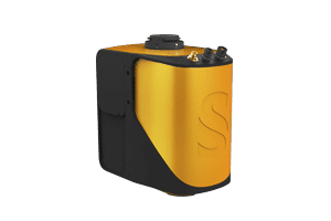
RESEPI GEN II LiDAR Scanning Solution by Inertial Labs, a VIAVI Solutions Company

Lidar, or LiDAR (a portmanteau of light and radar, also interpreted as an acronym for “Light Detection And Ranging”), is a distance-measuring and imaging technology that uses pulses of light in the form of a laser beam from the ultraviolet, visible and infrared portions of the electromagnetic spectrum.

These pulses of light are reflected, typically via backscattering, by the object under measurement. The LiDAR sensor measures the time taken for the pulse reflection to return and can thus calculate the distance from the object.

Drone LiDAR Systems & Scanning Methods

Aerial LiDAR by YellowScan

YellowScan Navigator Bathymetric & Topographic LiDAR Survey Solution

There are two general methods of detection – incoherent or direct energy detection, which is used for amplitude measurements, and coherent detection, for phase-sensitive measurements. LiDAR can be used to scan a wide variety of materials and the wavelength of the emitted laser is varied to suit the target.

Drone-Mounted LiDAR Scanners

UAV LiDAR by Areté

LiSA UAS-Deployable Situational Awareness LiDAR by Areté

When combined with a GPS receiver, inertial measurement unit (IMU) and onboard computer, a LiDAR sensor can be installed on a drone or UAV and used to scan a large area, with tens of thousands of points per second being measured.

The reflection time interval data is post-processed, converted to distance and correlated with data from the GPS receiver and IMU, which provide highly accurate information on the unmanned aircraft’s position and attitude respectively. The resulting 3D point cloud can be used to build up a detailed image of the surveyed area and provide vital insights to decision-makers.

Applications

What is lidar used for?

LiDAR mapping and surveying is used to gather accurate, precise data on both manmade and natural environments. Applications include cartography, agriculture, forestry, meteorology, mining, environmental management, inspection of utility lines and transport networks, and many other fields.

LiDAR is also used in UAVs and other unmanned systems for obstacle detection, collision avoidance and safe automatic landing. It is currently one of the leading technologies being utilized in the development of autonomous driving vehicles and self-driving cars.

Drone LiDAR FAQ’s

Drone LiDAR Sensor by RIEGL

RIEGL VUX-10025 UAV LiDAR Scanner

What is airborne LiDAR?

An airborne LiDAR system consists of one or more LiDAR sensors mounted on a fixed-wing, rotary manned or unmanned aircraft.

Can LiDAR penetrate clouds?

Due to the relatively short wavelengths, LiDAR pulses are unable to penetrate through most thicknesses of cloud cover.

How does LiDAR technology work?

Pulses of light from an ultraviolet, visible or infrared laser beam are reflected, typically via backscattering, by an object under measurement. The LiDAR sensor measures the time taken between emission of the pulse and the detection of the pulse reflection, and can thus calculate the distance from the object.

Related Articles

YellowScan Unveils NDAA-Compliant Venturer LiDAR

YellowScan debuted a new survey-grade solution at Geo Week 2026 focusing on local data processing and universal UAV compatibility for demanding environments

Mar 05, 2026
Mapping Whitewater Rivers with Bathymetric LiDAR

Riegl demonstrates how advanced bathymetric LiDAR waveform processing enables accurate river bed mapping in turbulent whitewater mountain river environments

Feb 04, 2026
Cellen Successfully Integrates YellowScan LiDAR on H2-6 Multirotor UAS

Cellen has expanded the payload options of its hydrogen-powered H2-6 multirotor UAS through the integration of YellowScan LiDAR payloads to support mapping and surveying applications

Feb 02, 2026
CHC Navigation Launches APACHE 6 USV for Enhanced Multibeam & 3D Marine Mapping

CHC Navigation has released its 2026 Edition USV integrating multibeam sonar, optional iLiDAR, and automated sound velocity profiling for high-resolution bathymetric mapping and efficient dual-domain marine and terrestrial surveys

Jan 27, 2026
Aeva Omni 4D LiDAR Introduced for Short-Range Physical AI

Next-generation Aeva Omni 4D LiDAR, developed with LG Innotek, delivers wide-view short-range perception using FMCW technology to enable physical AI applications across autonomous vehicles, robotics, drones, and smart infrastructure

Jan 12, 2026
UAV LiDAR Missions Gain Added Safety Through YellowScan–Drone Rescue Systems Partnership

YellowScan and Drone Rescue Systems have partnered to enhance UAV LiDAR mission safety, regulatory compliance, and operational reliability in demanding environments

Jan 06, 2026
Voyant Unveils Fully Solid-State 4D LiDAR & Silicon Photonics Platform

The new Helium platform from Voyant Photonics eliminates moving parts to provide high-resolution velocity and depth data for the next generation of industrial robotics

Dec 19, 2025
Acecore Integrates Topo-Bathymetric LiDAR Sensor on Noa Hexacopter

Acecore Technologies has integrated RIEGL’s VUX-820-G topo-bathymetric LiDAR system with its Noa hexacopter, with the sensor featuring integrated RGB imaging and RiLOC-F navigation to support survey, inspection, and mapping applications

Dec 15, 2025
YellowScan Navigator Bathymetric LiDAR System Showcased at French Manufacturing Exhibition

YellowScan demonstrated its Navigator Bathymetric LiDAR system at the 5th Grande Exposition du Fabriqué en France, showcasing French-made drone technology for coastal mapping developed with local partners and recognized by French authorities for innovation and industrial excellence

Dec 05, 2025