


Suppliers
Add your company
Trillium Engineering
UAV Gimbal Payloads - EO & EO/IR Drone Camera Gimbals for Tactical UAS
Platinum Partner

Exail
Inertial Navigation & Positioning Technology for Unmanned, Autonomous Systems
Platinum Partner

SBG Systems
Inertial Navigation Systems, INS/GPS, AHRS, and IMU Sensors for Unmanned Systems

Platinum Partner


Neousys Technology
Industrial-Grade Embedded Computer Systems for AI Edge Computing & Machine Learning
Gold Partner

uAvionix Corporation
Certified UAV Communications, Navigation, Control, Surveillance, and Combat ID Solutions

Gold Partner


Sightline Intelligence
Onboard Video Processing Software and Hardware for Unmanned Systems
Gold Partner
Cambridge Pixel
Radar Software & Sensor Processing Solutions, Maritime Radar Control, Tracking & Visualization for USV
Silver Partner

EIZO Rugged Solutions
High-Performance Video Graphics, GPGPU, AI/ML Processing & Display Solutions for C5ISR Applications

Silver Partner

CHC Navigation
GNSS Positioning & Navigation Systems, Mobile Mapping UAV LiDAR & Unmanned Surface Vehicles
Silver Partner

Sunhillo Corporation
Radar & ADS-B Surveillance Data Fusion, Integration & Display | UAV Tracking & ATC Integration
Silver Partner
Showcase your capabilities
If you design, build or supply Data Processing, create a profile to showcase your capabilities on this page
Products


Data Processing for UAVs & Unmanned Vehicles

Drone data processing refers to the techniques and technologies used to transform raw data captured by UAVs (unmanned aerial vehicles), UUVs (unmanned underwater vehicles), and USVs (unmanned surface vessels) into usable outputs. These outputs may include orthophotos, 3D models, maps, volumetric calculations, or real-time alerts. Effective processing allows informed decision-making across applications such as precision agriculture, infrastructure inspection, environmental monitoring, and search and rescue.
Data gathered in the field is typically processed using desktop software, cloud-based platforms, or third-party service providers. The choice of workflow depends on factors such as data size, required accuracy, turnaround time, and available computing resources.
Drone Data Types Explained
Modern unmanned systems have advanced sensors and imaging systems that collect diverse data types. These datasets vary in format, processing requirements, and practical applications.
Visual (RGB) Imagery
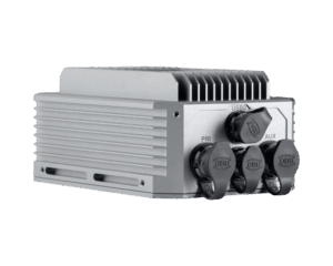
Clarity-HD Drone Data Processing Solution by Trillium Engineering
Captured using standard red-green-blue cameras, RGB imagery forms the foundation for many mapping and inspection tasks. It’s widely used in photogrammetry and visual analytics.
- Sources: Digital cameras mounted on drones with gimbals for stability.
- Processing: Image stitching, orthorectification, georeferencing, resolution enhancement.
- Applications: Construction site monitoring, roof inspection, orthophotography generation, land use planning, and urban development.
Thermal Infrared Data
Thermal sensors detect heat variations, useful for detecting equipment faults, energy inefficiencies, and living organisms.
- Sources: Long-wave infrared sensors like FLIR systems.
- Processing: Temperature calibration, contrast tuning, automated anomaly detection.
- Applications: Solar farm inspection, fire monitoring, search and rescue, wildlife tracking, power line inspection.
Multispectral Data
Multispectral sensors capture images at specific wavelength bands beyond visible light. These are essential for biological and environmental analysis.
- Sources: Cameras and CCD (charge-coupled device) sensors.
- Processing: Band alignment, NDVI/NDRE calculation, data normalization.
- Applications: Crop health monitoring, precision agriculture, forestry management, flood risk assessment.
Hyperspectral Data
Hyperspectral sensors record hundreds of narrow spectral bands, allowing detection of subtle material differences.
- Sources: High-end hyperspectral cameras used on heavier UAV platforms.
- Processing: Dimensionality reduction, spectral classification, anomaly detection.
- Applications: Pollution analysis, mineral exploration, forensic assessments, and crop disease identification.
LiDAR (Light Detection and Ranging)
LiDAR sensors emit laser pulses to create high-resolution 3D maps and point clouds, independent of lighting.
- Sources: UAV-mounted rotating or solid-state LiDAR systems.
- Processing: Point cloud classification, filtering, 3D reconstruction, SLAM.
- Applications: Topographic surveys, forestry canopy mapping, volumetric analysis, pipeline monitoring, infrastructure inspection.
GNSS & IMU Telemetry
Positional and inertial data from GNSS receivers and IMUs are critical for accurate georeferencing and navigation.
- Sources: Onboard GNSS units, IMUs, barometers, and magnetometers.
- Processing: Flight path reconstruction, sensor calibration, data integrity validation.
- Applications: GNSS-denied navigation, flight planning, autonomous control, battlefield mapping.
Sonar & Acoustic Data
UUVs and AUVs use sonar to map underwater terrain and detect objects in subaquatic environments.
- Sources: Multibeam or side-scan sonar systems.
- Processing: Signal filtering, acoustic modeling, 3D rendering of seabeds.
- Applications: Underwater mapping, oil spill detection, archaeological exploration, and marine surveillance.
Data Processing Methods & Workflows
Drone data processing typically follows one of three pathways, each suited to different operational needs, levels of expertise, and project scales:
Local Processing
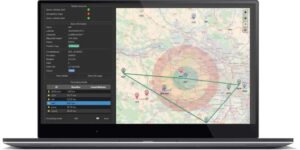
Qinertia Post-Processing Software by SBG Systems
Data is processed using software installed on a desktop computer or local server, offering full control over the workflow and ensuring complete data privacy.
- Considerations: Requires powerful computing hardware, ample data storage, and skilled technical personnel. Best suited for small to medium-sized datasets or sensitive data requiring offline handling.
- Benefits: Full control over the processing pipeline, improved data security, and no reliance on internet connectivity.
Cloud-Based Processing
Cloud platforms provide automated processing and utilize scalable remote computing power, enabling rapid handling of large and complex datasets.
- Considerations: Requires stable internet access and may involve subscription costs. Data security and privacy policies must align with user needs.
- Benefits: Scalability, faster processing, seamless collaboration, and AI-powered automation for tasks like object detection and change analysis.
Third-Party Processing
Specialized service providers manage the entire data processing workflow using professional-grade tools and expert personnel.
- Considerations: Limited control over the process; turnaround times and service levels depend on provider agreements.
- Benefits: Access to skilled analysts, high-quality results, optimized workflows for complex datasets, and reduced internal resource demands.
Key Technologies & Techniques in Drone Data Processing
Drone data is rarely useful in its raw form. Effective processing techniques include:
- Photogrammetry: Converting overlapping images into georeferenced 2D and 3D models for use in construction, agriculture, and surveying.
- AI and deep learning: Used for automated object recognition, target tracking, noise reduction, and anomaly detection.
- Sensor fusion: Merging multiple sensor streams, e.g., RGB + LiDAR or multispectral + thermal, for enhanced situational awareness.
- Edge computing: Onboard processing that enables real-time decision-making, useful in critical missions like disaster response and military reconnaissance.
- Signal processing and filtering: Reducing sensor noise and enhancing clarity for sonar, hyperspectral, and telemetry data.
- Data encryption and integrity checks: Essential for secure data exchange in defense and infrastructure monitoring applications.
Real-World Applications Across Industries
Drone data processing drives insights in a wide array of sectors:
- Agriculture: Assessing crop health, irrigation planning, and yield prediction via multispectral and hyperspectral analysis.
- Construction and urban planning: Monitoring project progress, performing volumetric analysis, and enabling 3D city modeling.
- Environmental science: Mapping land cover, evaluating flood risks, and tracking changes over time with photogrammetric and LiDAR data.
- Energy and utilities: Inspecting wind turbines, power lines, solar farms, and oil pipelines using RGB, thermal, and LiDAR imaging.
- Disaster response and emergency services: Rapid terrain mapping, search and rescue support, and coordination of responders.
- Defense and public safety: Battlefield mapping, GNSS-denied operations, real-time surveillance, and drone swarm coordination.
Integration with Autonomous Systems & Drone Swarms
Advanced data processing is fundamental to enabling autonomy in UAVs. Real-time analytics, sensor fusion, and edge AI are essential for:
- Path planning optimization
- Obstacle detection and avoidance
- Communication, relay, and coordination in drone swarms
- GNSS-denied and terrain-aware navigation
- Real-time surveillance and target tracking in dynamic environments
These capabilities rely heavily on fast, reliable data processing onboard or via secure, low-latency links to ground control stations.
From Data to Meaningful Data
Drone data processing is the critical bridge between raw sensor output and meaningful, mission-critical insights. Whether it’s imagery, LiDAR, thermal, sonar, or telemetry, the ability to collect and process data effectively determines the success of unmanned operations. With a wide range of tools, photogrammetry, AI analytics, edge computing, and data fusion, this field enables applications across agriculture, construction, defense, and beyond.
As sensors improve and drones become more autonomous, the scale, complexity, and speed of drone data processing will continue to grow. Choosing the right tools and workflows is essential for turning UAV data into knowledge and knowledge into action.


